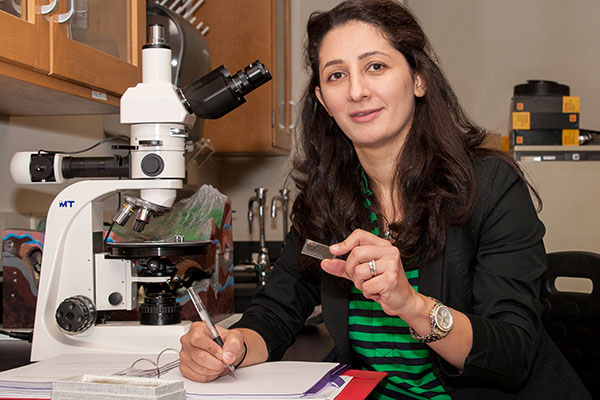
Jamie Mitchem
I earned the Ph.D. degree in Geography from the University of South Carolina; the M.S. degree in Meteorology from North Carolina State University; and the B.S. degree in Geophysics from the University of South Carolina. I was enrolled as a student in the USC Honors College which is the number one public university honors college in the United States. I was also fortunate to participate in the National Student Exchange to Florida State University in my junior year.
I am currently a Professor of Geography/GIS and I teach three Geography courses (1102, 1111K, 1112/L) and six GIS courses (2011/L, 3011K, 3100, 4020K, 4035L, 4983) and serve as an advisor for the B.S. degree in Applied Environmental and Spatial Analysis students. I’m also the co-advisor for the Geospatial Alliance Student Club, oversee GIS internships, conduct research, and serve on committees.
There are five dimensions to my field – all of which interest me.
1) Interdisciplinary – There are applications in almost every discipline from tornadoes to politics to education. Anything with a location can be mapped and analyzed using geospatial technologies such as GIS, GPS, and remote sensing.
2) Powerful - It has been said that a picture is worth a1000 words but an effective map is worth 1,000,000 words so the study of GIS is a powerful overlay in today’s society.
3) Dynamic – This is a rapidly changing and growing field which keeps me excited and engaged.
4) Informative – I enjoy exploring how humans interact with our environment and studying the earth system’s influence on society which is often expressed through disasters such as Hurricane Sandy or the Japanese tsunami. These events can teach and motivate us to create a harmonious and sustainable relationship.
5) Relevant – These cutting edge technologies and geospatial intelligence can be used for many purposes and provides a variety of opportunities for UNG to become an even bigger power player in the geospatial industry.
Geospatial technology is an exciting high growth industry in which UNG has a Certificate and Bachelor’s degree in Applied Environmental and Spatial Analysis (AESA). Even if not majoring in AESA, I would highly recommend students to take the Intro to GIS course (GISC 2011/L) since it applies to most disciplines. Geospatial technology has the power to uncover invisible boundaries in society, develop situational awareness in combat zones, provide strategic planning tools for businesses, be implemented as an additional tool for educators, and inform scientific policy. It is truly revolutionary technology!
I have been honored to serve on the Faculty Senate, American Democracy Project Committee, UNG Promotion and Tenure Committee, chair of a search committee, and two consolidation work groups. While not always celebrated, I believe committee work is very important to unite the University, provide faculty with a voice in governance, and help UNG function effectively and efficiently.
I also enjoy conducting research that exposes important current issues and addresses future challenges. From investigating social vulnerability to disasters to analyzing the reasons for the student debt crisis or income inequality to addressing the threats of climate change, GIS can address the big questions in the world.
But most of all, my teaching inspires me. One of my favorite days is when students present their projects in class and I observe their creativity, knowledge, and pride in their work. They always impress me with their quality and range of applications from mapping food bank needs to modeling dam break scenarios to analyzing transportation proposals for Atlanta. It gives me great pleasure to see students succeed in class, contribute to society through internships and service learning projects, and go on to establish productive careers in this discipline. Last week, an alumnus who is attending graduate school at NYU emailed us to thank us for giving him an educational advantage over his fellow graduate students. He is currently involved in a project with urban planning in New York City. That made my day!
Since coming to Gainesville and UNG, I received my GIS Professional (GISP) certification from the GIS Certification Institute which requires applicants to earn points based on experience, education, ethics, and contributions to the profession. There are approximately 5000 GISPs worldwide scattered over all 50 states and 25 other countries. The application and supporting documentation was over 100 pages long so it is an achievement that I am very proud to have attained.
Another honor I share with my colleagues is that IESA was selected by the USG’s Academic Affairs office as one of two recipients of the Board of Regents’ Teaching Excellence Award for Departments or Programs in 2012. I am thrilled that my colleagues and I were recognized by Georgia’s educational leaders as an innovative and successful Institute.
Along with JB Sharma and Zac Miller, we’ve established an educational partnership with AGI. They develop commercial modeling and analysis software for the space, defense, and intelligence communities.
I have given numerous professional presentations at conferences including CDC, AMS, AAG, FEMA, and Georgia GIS Conference; have authored entries in the Encyclopedia of Disaster Relief and Encyclopedia of Crisis Management; and published an article in The Pennsylvania Geographer. I enjoy speaking to community groups such as the Columbus Museum, Elachee Nature Center’s summer camps, and even a preschool at Jefferson First Baptist Church. I also mentored my cartography class students to partner with middle school students to map biomes at the Da Vinci Academy and with county agencies in Stephens County to map some of their data. Finally, I have led workshops on the applications of GIS for Emergency Management at FEMA’s Higher Education Conference at the Emergency Management Institute in Emmitsburg, MD.
As I teach, advise, and interact with students, I hope they develop a love of learning, an inquisitive nature, critical thinking skills, and a respect for the value of education so they will continue to grow intellectually beyond the classroom. From a practical perspective, I hope they acquire knowledge and technological skills to make them marketable as productive employees, innovative entrepreneurs, or inspirational educators. On a personal note, I truly care about them and I want them to succeed by doing their best by being empowered with a can-do attitude, ambition, confidence, and creativity. Finally, I mentor them to have a sense of respect and awe for the world around them, recognition of the vital link between humans and our environment, and how to address challenges from local to global scales to make a better future.
A lot of people find it interesting that I used to lead storm chases in Tornado Alley.
I was also the first recipient of the National HAZUS User of the Month Award presented by FEMA. Consequently the Three Rivers HAZUS User Group has named an “outstanding service award” in my honor.
To learn more about GIS, Google search the “Geospatial Revolution Project” (Penn State) to see some outstanding videos that explain the power of geospatial technologies for a variety of purposes such as business, military, scientific research, disaster relief and access to healthy food.

