IESA gains approval for master's degree

The University of North Georgia (UNG) will launch a Master of Science in spatial data and information sciences in fall 2023 through the Lewis F. Rogers Institute for Environmental and Spatial Analysis (IESA), pending Southern Association of Colleges and Schools Commission on Colleges approval.
UNG received University System of Georgia (USG) Board of Regents approval Aug. 9.
The degree will be available on the Gainesville Campus for both full-time students and part-time students who are working professionals. It will help students prepare for careers as statisticians, cartographers and photogrammetrists, computer and information research scientists, surveyors, and geoscientists.
"We are honored to receive approval of our master's degree," Dr. Jeff Turk, dean of IESA, said. "IESA faculty and staff look forward to this new opportunity of providing graduate degrees to our service area and beyond in the high-demand field of spatial data and information sciences."
The Georgia Governor's High Demand Career Initiative Report lists data science, which includes spatial and geospatial data science, as a high-demand career area. Likewise, the 2018 Georgia Workforce Innovation and Opportunity Act lists many similar careers as high-demand fields. The Master of Science program is designed to develop and refine these skills in students to meet workforce and societal needs.
The program is aimed at students interested in developing and applying a high level of spatial data, science, technology, and expertise applicable to a wide variety of issues and needs. Spatial data science can be applied in any field where data sets and geography intersect.We are honored to receive approval of our master's degree. IESA faculty and staff look forward to this new opportunity of providing graduate degrees to our service area and beyond in the high-demand field of spatial data and information sciences.
Dr. Jeff Turk
Lewis F. Rogers Institute for Environmental and Spatial Analysis dean
These applications include disaster planning, emergency management, military intelligence, spatial data science and analytics, geodesign, modern and sustainable infrastructure planning, natural resource analysis and management, and mitigating issues associated with extreme weather events.
The program intends to provide students a breadth of knowledge in general research skills and theory appropriate at the master's level to educate students how to conduct research or complete projects and how to present and disseminate their findings.
Both thesis and non-thesis options are available for the program.
Students will focus on innovation in the field of spatial machine learning, where algorithms and approaches incorporate space into their computation skillset. This will allow the students to take advantage of the latest advances in technology and computing, while concurrently focusing on applied research in solving problems and decision-making based on spatial data and information.
As a senior military college, UNG is a prime location for master's-level studies that support the military mission and can attract active-duty military personnel seeking graduate studies to enhance their role as leaders and defenders of the nation. Advanced spatial and geospatial technology is one of the mainstays of present-day military operations.
Nilsson lands STEM fellowship, grant
UNG student Helene Nilsson has been selected for the STEM NetX Fellowship and earned a grant from the fellowship to support her research with Dr. Amber Ignatius.
Zavarce shines as leader, researcher
Albany Zavarce will graduate this week with a bachelor's degree in environmental spatial analysis. She has been an active student leader and researcher.
Earth Day event is set for April 15
UNG will host its ninth annual Earth Day celebration from 11 a.m. to 2 p.m. April 15 at UNG's Gainesville Campus.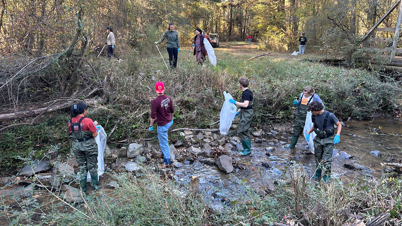
Students clean up Tumbling Creek
A group of nearly 70 UNG students conducted their biannual cleanup of Tumbling Creek Woods, which is adjacent to UNG's Gainesville Campus.