Current Updates by Campus:
- Dahlonega
- Gainesville
- Oconee
- Blue Ridge (none)
- Cumming (none)
Dahlonega Map Updates
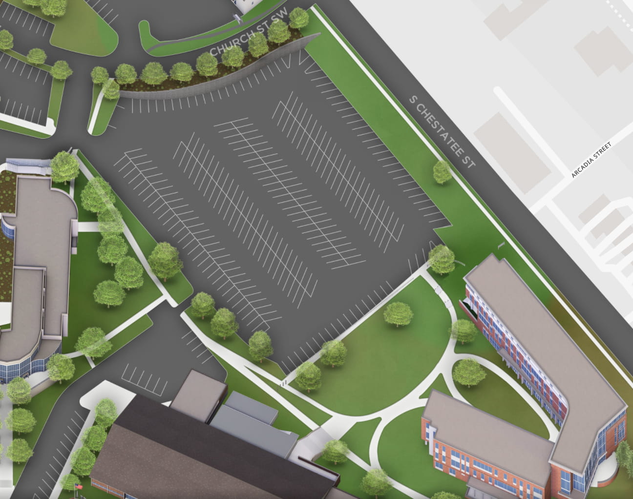
L16 - East Faculty Lot
This is the lot between the new Cottrell building, the Newton-Oakes center, and the Church Street House (Parking Services).
Use the slide bar below to progress through several steps of changes.
- Original Map
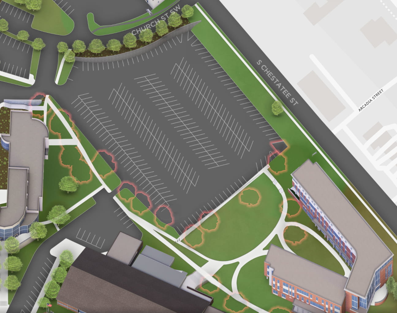
- Remove excess greenery
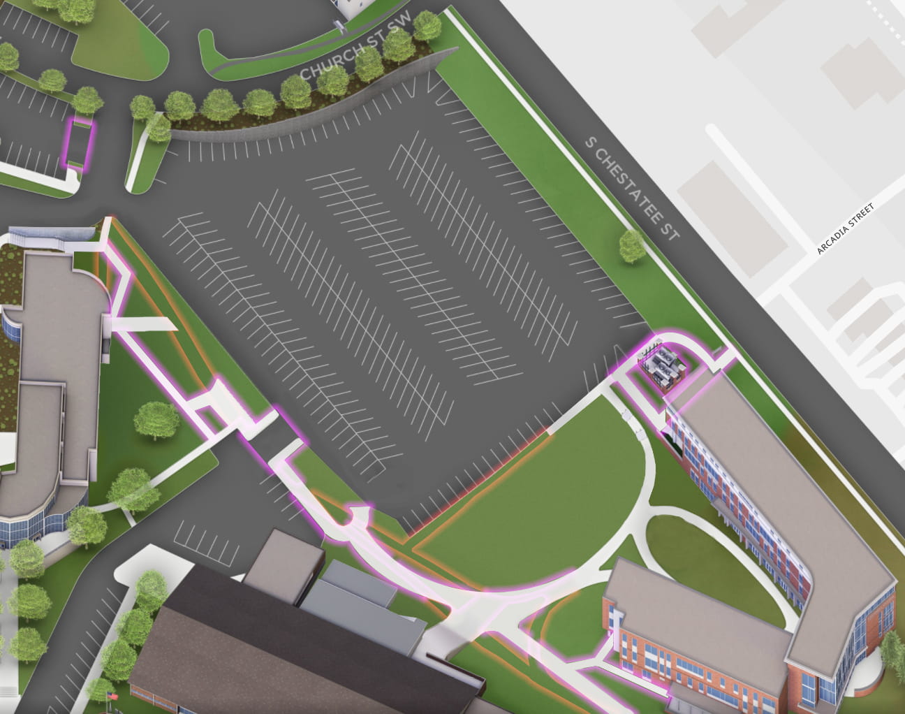
- Add/Remove Walkways and Driveways (& add HVAC)
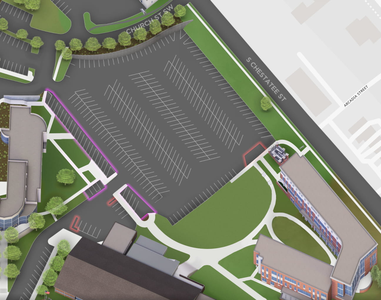
- Add/Remove Parking Spaces
Remove Excess Greenery
- [REMOVE] (18) trees inside/touching the triangle created between the eastern tip of Memorial Hall, the northern tip of the Cottrell Building, and the northern tip of the Newton-Oakes Center.
- [REMOVE] The patch of grass in the east corner of Lot 16 to create a right-angle corner of asphalt.
Add/Remove Driways and Walkways
- [ADD] Rear Driveway to L15: "Visitor Parking Lot"
- [WIDEN] The bi-directional Driveway between L16 and L17.
- [ADD] Sidewalk on either side of the driveway between L16 and L17.
- [REMOVE] Sidewalk running parallel to the southwest edge of L16.
- [REMOVE] Sidewalk along the southeast edge of L16; from the south corner up to end of the 16th parking slot.
- [ADD] Sidewalk from the NOC's northeast door straight to the the second ADA parking slot in the north side of L17.
- [MOVE] The corner of the triangle created by the sidewalk east of L17, down to where the edges of the southeast edge of L16 and the northeast edge of L17 would meet if they continued.
- [ADD] The "d"-shaped sidewalk (tilted 45° clockwise) behind the northwest corner of the new Cottrell building.
- The top of the "d" should connect with the sidewalk alongside Chestatee street.
- All corners of the "d" are square, except for the top-left (accessible ramp), which is rounded.
- Inside the d's loop is a pen of HVAC units. The pen has brick columns with black iron rod fencing between the columns.
Add/Remove Parking Spaces
- [ADD] Row of parking spaces along southwest edge of L16.
- Spaces from top-left (all angled northward):
14 F/S, 1 Accessibility ("a11y"), 1 Access Aisle("AA"), 2 a11y, 1AA, 1 a11y,
[driveway to L17], 4 F/S.
- Spaces from top-left (all angled northward):
- [REMOVE] 3 spaces (and "gore" triangle) directly in front of Cottrell's northwest entrance.
- [REMOVE] The northern-most space from both the L16 side and the Memorial Hall side of L17 backlot
- [ADD] 4 spaces in the northern nook of L17, the third space is an "Accessibility Aisle" however.
Ball Fields
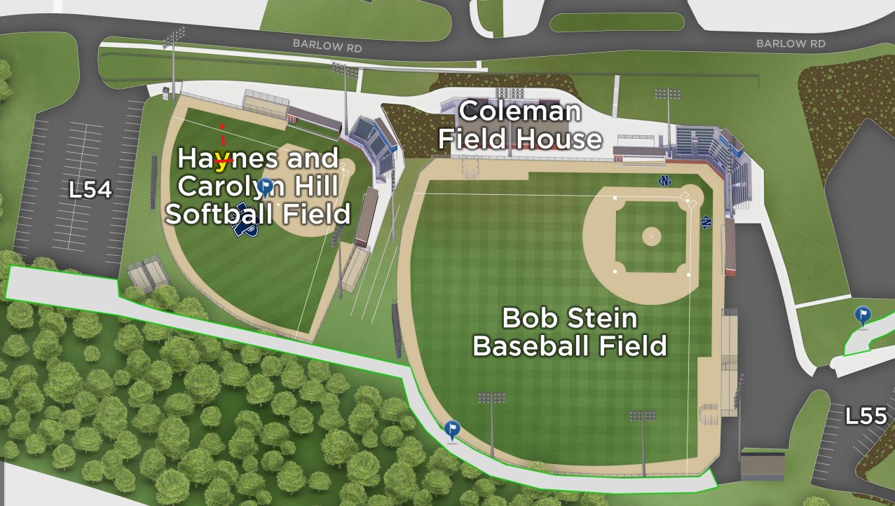
- [CORRECT LABEL] Change "Haynes" to "Haines".
- [ADD] Concrete pad (color: light gray, like sidewalks), almost like an extension to the south end of 'Lot 54'.
- [ADD] Sidewalk, connecting the new concrete pad (south of 'Lot 54') to the equipment shed at the southeast corner of the Baseball field. The path is straight from concrete pad to the Baseball field with top edge just "kissing" the southeast corner of the softball field as it passes it, then wraps along the remainder of the outfield fencing of the baseball field until it meets the asphalt in front of the aforementioned equipment shed.
Additional note found for: "Softball and Baseball Parking Lot expansions? - Morgan Mitchell/Hank Haines"? Needs more context.
Soccer Field
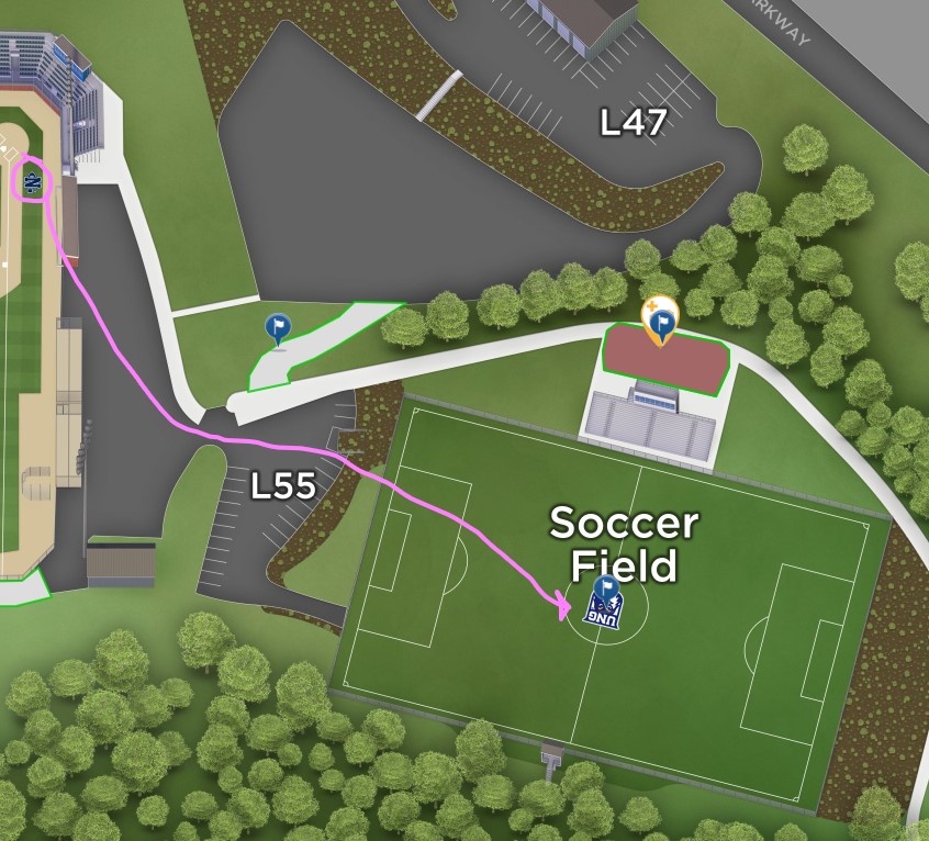
- [REPLACE] Change "Mascot Shield Logo" to "NG" athletics logo (as seen in baseball field.)
- [ADD] Soccer team [and equipment storage] structure (no label necessary) behind bleachers [northeasterly]
- [ADD] Concrete connector (Golf cart/"EMS"?) path north of 'Lot 55' (color: light gray- like sidewalks)