Skip to Main Content Skip to Main Navigation Skip to Footer
UNG Logo
  • Info For...
    • Accepted Students
    • Current Students
    • Parents & Family
    • Faculty & Staff
    • Alumni
    • Business & Community
    • International Students
  • Quicklinks
    • Directories
    • myUNG
    • Academic Catalogs
    • Athletics
    • Banner
    • Bookstore
    • Calendars
    • Campuses & Maps
    • Continuing Education
    • D2L
    • Employment / HR
    • IT Service Desk
    • Libraries
    • UNG Foundation
  • Admissions
  • Corps of Cadets
  • Academics
  • Cost & Aid
  • Student Life
  • News & Events
  • Athletics
  • About Us

Find the most up-to-date information on the Presidential Search site.

Institute for Environmental & Spatial Analysis
  • Academics
    Undergraduate
    Environmental Spatial Analysis (B.S.) Environmental, Earth & World Studies, and Spatial Science & Engineering (A.S.)
    Minors
    Earth Science Minor Environmental Studies Minor Geography Minor Geospatial Science & Technology Minor Space Studies Minor
    Certificate
    Earth Science Certificate Environmental Science Certificate Environmental Studies Certificate Geographic Information Science Certificate Geomatics Graduate Certificate Geospatial Intelligence Certificate Geospatial Science Technology Graduate Certificate Land Surveying Certificate Space Studies Certificate
  • For Students
    Advising at IESA Clubs & Organizations
    Internships Academic Advising
    Career Services Tutoring Services
    Supplemental Instruction Earth Day 2023
  • Research Grants
    Applying Geospatial & Engineering Technology
    Developing Georgia's Women Leaders in GIS
    Environmental Education
    GEOPAths Grant
  • Outreach
    K-12
    GeoEd Workshop GIS Competition Geospatial Education National Intelligence Summer Academy (NISA)
    Community
    Environmental Education Workshops Tree Identification Survey Earth Day 2023
  • About
    Industry Partnerships Awards & Recognition Alumni Spotlights
    Highlighted Student Projects Give to IESA
  • Contact
    1. UNG
    2. Academics

    Lewis F. Rogers Institute for Environmental & Spatial Analysis

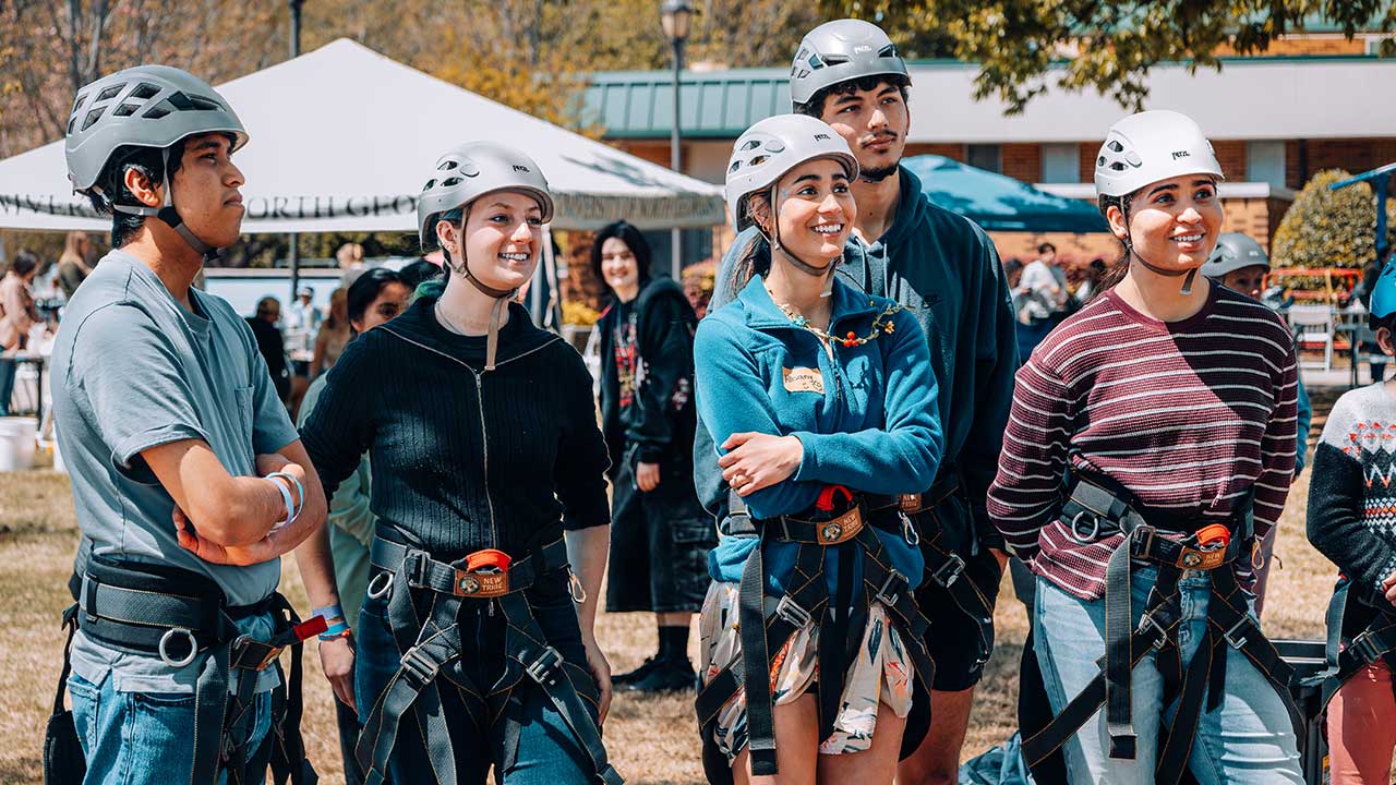
    The Lewis F. Rogers Institute for Environmental and Spatial Analysis (IESA) promotes environmental education through interdisciplinary instruction and collaborative learning. IESA is designed for inquisitive minds craving to cast a brighter light upon Earth's many mysterious eon-spanning processes. The curriculum directs students to discover and explore new focus areas within geoscience such as environmental-health, -engineering, -education, -urban planning, and community development. During their experience, students will earn work-ready training through internships, community service, and research projects that will carry them confidently forward to fulfilling employment or reputable graduate schools.

    Degrees, Minors, and Certificates Offered

    IESA also participates in the Academic Common Market, where out-of-state students can qualify for in-state tuition when enrolling in select degree programs. Learn more about the Academic Common Market.

    • What is Geospatial Technology, GIS, and Geoscience?

      Geospatial refers to location-specific data, while the term geospatial technology refers to the modern tools (surveying equipment, drones, sensors, satellites, GIS software) and processes used to contribute to the collection, analysis, and mapping associated with Earth’s resources.

      GIS, or geographical information systems, are databases that contain geographic (or spatial) data, along with software tools to manage, analyze, and visualize those data. Examples of GIS data could include aerial photos, elevations, temperatures, and other information associated with a place or area. Such data can be collected in several ways including the use of remote sensing, which allows for the acquisition of information from afar using geospatial technologies.

      Geoscience is the study of the earth’s processes, natural resources, and their connections with other things and each other.

    • What Can You Do With a Career in Environmental and Spatial Analysis?

      Geospatial and environmental professionals often work indoors and outdoors to utilize handheld technologies for field data collection and further computer lab analysis. Some technicians fly UAVs (drones) to collect aerial imagery of environmental conditions and then process the imagery alongside their other mapping data. Demand for surveying services is closely tied to construction activity, and job opportunities will vary by geographic region, often depending on local economic conditions. Increasing use of geographic technologies and data will drive employment growth in the careers of surveying, mapping technicians, geographers, environmental engineering, urban planning, and community development.

      Careers & Salaries

      Most work full time, which is at least 40 hours per week. Individuals can expect both field work and indoor work. When working outside, you may stand for long periods and often walk long distances, sometimes in bad weather. 

      Survey & Mapping Technicians: median annual wage $46,200 / $22.21 per hour (2021)

      Surveyors: median annual wage $65,590 / $31.54 per hour (2022)

      Geographers: median annual wage $85,430 / $41.07 per hour (2021)

      Cartographers & Photogrammetrists: median annual wage $68,380 / $32.88 per hour (2022)

      Hydrologists: median annual wage $84,040 / $40.41 per hour (2022)

      Database Administrators: median annual wage $98,860 / $47.53 per hour (2022)

      Bureau of Labor Statistics, U.S. Department of Labor, Occupational Outlook Handbook, 2021-2022 Edition

      • Discovering GIS as a Career Choice
      • Job Resources & Major-Specific Professional Organizations
      • See Job Announcements on the UNG Job Board

      AGET Technician Career Pathways

      • High School and Technical College Recruitment leads to
        • Transferred credits from accredited technical college and
        • High School Diploma or GED equivalent
        • Transferred credits from accredited technical college leads to
          • Proposed A.S. degree: Geospatial Engineering and Technology with Directed Emphasis Areas
        • High School Diploma or GED equivalent also leads to
          • Proposed A.S. degree: Geospatial Engineering and Technology with Directed Emphasis Areas

            • Proposed A.S. degree: Geospatial Engineering and Technology with Directed Emphasis Areas 
            • Supplemental Instruction (if needed) also leads to
              • Proposed A.S. degree: Geospatial Engineering and Technology with Directed Emphasis Areas
              • Proposed A.S. degree: Geospatial Engineering and Technology with Directed Emphasis Areas with Proposed Land Surveying Certificate (optional) leads to
                • Georgia Land Surveyor in Training (LSIT) exam
              • Proposed A.S. degree: Geospatial Engineering and Technology with Directed Emphasis Areas also leads to
                • Agriculture Technician
                • Forest and Conservation Technician
                • Environmental Science Technician
                • Civil Engineering Technician
                • Geology Technician
                • Surveying and Mapping Technician
    • Information for Dual Enrollment Students

      The following IESA sponsored courses are approved for dual enrollment students. These courses satisfy the general core curriculum requirements for any major and in Area F for the Associate of Science Degree in Environmental, Earth and World Studies, and Spatial Science and Engineering for the Bachelor of Science Degree in Environmental and Spatial Analysis. The main benefit of dual enrollment classes provide high school students with both high school credits towards graduation and college credits which can be applied towards a degree to be earned at the University of North Georgia or transferred to another institution of higher learning. For more information about dual enrollment visit the Georgia Futures website or the UNG Advising pages.

      • ENST 2030: Environmental Studies
      • ENVE 2221K: Surveying I
      • ENVE 2222K: Surveying II
      • GEOG 1111K: Introduction to Physical Geography  
      • GEOG 1112K: Weather and Climate
      • GEOG 1101: Human Geography
      • GEOG 1102: World Regional Geography
      • GEOL 1121K: Physical Geology        
      • GEOL 1122K: Historical Geology
      • GISC 2011/L: Intro to GIS

      To meet with a STEM advisor for assistance in selecting the appropriate courses to meet your academic goals, please email iesa@ung.edu. Learn more about how to apply for dual and joint enrollment.

    • IESA Newsletter and Videos

      2022 IESA Winter Newsletter (PDF)

      IESA Opportunities Video

      Data Collection Video

      Applying Geospatial and Engineering Technology Project

    Support an IESA Student Today

    Nurture a brighter future for an aspiring GIS expert by donating to the scholarship fund for IESA students, established by the UNG Foundation.

    Donate Now

    united states geospatical intellignence logo

    Recipient of United States Geospatial Intelligence Foundation Accreditation

    NSF opens new window to the National Science Foundation website

    Recipient of the Applying Geospatial and Engineering Technology Grant.

    Recipient of Environmental Education Grant Program (Region 4)

    Geotech

    Educational affiliate with the National Geospatial Technology Center of Excellence (GeoTech Center).

    Join a Student Club!

    Visit these clubs to experience the rewards of networking with like-minded individuals and cultivating a united community.
    • GeoSpatial Alliance
    • GeoScience
    • Engineering
    • AIPG
    • Environmental Club

    GeoSpatial Alliance

    Geospatial Alliance Club

    Meets every Monday at noon on the Gainesville campus, The Arts and Technology building, Room 1908.

    Faculty Advisors

    • Dr. Amber Ignatius 

    Student President

    • Michael Wild

    UNG Geospatial Alliance

    • Visit the GeoSpatial Alliance Club on UNG Connect

    GeoScience

    GeoScience Association

    Meets every two weeks at the Gainesville campus on Mondays at noon.

    Advisors

    • Dr. Katayoun Mobasher
    • Dr. Jerry Allison
    • Dr. Chris Seminack

    • Visit the GeoScience Association on UNG Connect

    Engineering

    Engineering Club

    Meets every two weeks at the Gainesville campus on Fridays at noon.

    Advisors

    • Dr. Jeff Turk
    • Dr. Redahegn Sileshi

    • Visit the Engineering Club on UNG Connect

    AIPG

    Student Chapter of the
    American Institute for Professional Geologists

    Location

    Gainesville campus

    Advisor

    Dr. Katayoun Mobasher

    Environmental Club

    Environmental Club

    Location

    Oconee Campus

    Advisor

    • E. Njeri Marekia-Cleaveland, J.D.

    What's Shaking in Geoscience?

    UNG News

    GIS Day shines light on historical maps

    GIS Day shines light on historical maps

    UNG's Lewis F. Rogers Institute for Environmental and Spatial Analysis will host 'GIS Day: Mapping History' at 3 p.m. Nov. 16 to highlight historical maps of UNG and the surrounding area as part of the

    IESA gains approval for master's degree

    IESA gains approval for master's degree

    UNG plans to launch a Master of Science in spatial data and information sciences in fall 2023 after receiving University System of Georgia Board of Regents approval.

    IESA celebrates 20th anniversary

    IESA celebrates 20th anniversary

    On April 21, the Lewis F. Rogers Institute for Environmental and Spatial Analysis at UNG and its more than 100 students will mark the institute's 20th anniversary.

    Three UNG faculty to deliver commencement speeches

    Faculty to headline fall commencement

    Faculty members Dr. Katherine Adams, Dr. Timothy May, and Dr. Bryson Payne will be the keynote speakers at the fall 2021 commencement ceremonies at UNG.

    IESA to create 3D model for Oakwood project

    IESA assists city planners

    UNG students in the Lewis F. Rogers Institute for Environmental and Spatial Analysis will survey the land for the Oakwood downtown development project and prepare 3-D visualization of it.

    Previous Next

    Facebook Posts

    https://www.facebook.com/IESA-Lewis-F-Rogers-Institute-for-Environmental-and-Spatial-Analysis-172740422772626/
    No Results Found
    UNG Logo
    • Contact Us
    • Request Information
    • Quick Facts
    • Campus Maps & Directions
    • Student Consumer Information
    • Campus Safety
    • Emergency Information
    • Employment/HR
    • UNG Policies & Procedures
    • UNG Alumni Association
    • UNG Foundation
    • Ethics & Compliance Hotline
    • Human Trafficking Notice
    • Equal Empl. Opportunity

    © 2023 The University System of Georgia and the University of North Georgia.

    UNG follows the section 508 Standards and WCAG 2.0 for web accessibility. If you require this content in another format, please send an email to the ADA Coordinator.

    Use of military-themed imagery does not constitute endorsement by the U.S. Department of Defense.

    • Accreditation
    • Accessibility
    • Privacy Policy
    Establishing Connection...
    AskNigel