Alumni Focus
Corryn Smith (UNG '14) - Northern Arizona University (NAU) - Graduate Teacher Assistant

The Lewis F. Rogers Institute for Environmental and Spatial Analysis (IESA) regularly features graduates from its Bachelor of Science in environmental spatial analysis (ESA) and certificate programs in its "Alumni Focus." Because our graduates are hired for public and private sector jobs and accepted to graduate schools at a very high rate, we want to highlight these outstanding students and find out what made their experiences at UNG so unique.
What do you do at NAU?
As part of my contract with NAU, I work 20 hours a week. I do various tasks such as attending the classes I assist for, holding office hours, and grading assignments. This year, I’m helping with GSP 130: Intro to Mapping the World. This is a freshman level class to draw in undecided students into the geography program. This class focuses on creating Story Maps on ArcGIS Online, data collection with eTrex GPS units, how to read USGS topographic maps, and how to use Google Earth. Next year, I have been assigned to teach the lab portion of GSP 331/531: GIS Foundations I: Map Design and GIS; this is a split undergrad/grad level class that uses the Mastering GIS textbook. Although I enjoy working with underclassmen, I’m excited to get back into GIS.
What are your research interests?
I am currently enrolled at Northern Arizona University’s Flagstaff campus. I’m studying applied geospatial sciences under the Geography, Planning, and Recreation department. After graduating from UNG, it was difficult to find a graduate program that was different from IESA’s Environmental Spatial Analysis program. NAU’s program caught my attention since their program has different emphases that you can choose from. They have the geospatial emphasis which is very similar to my undergrad degree, a planning emphasis, recreation emphasis, or you can do a custom track. I am currently pursuing the planning emphasis where I’ve been taking classes such as Planning Laws and Ethics, Planning Sustainable Communities, Community Planning and GIS, and Data Analysis & the Digital Community. Aside from planning and GIS, I will be taking the Applied Remote Sensing class this Fall; although I have acquired several remote sensing techniques through IESA’s program, the class offered at NAU uses the Envi software which will be new to me.
Graduate students in the geospatial program have an option to do a thesis or a practicum. I decided I want to do a thesis, and my current topic is “The Modern Self-Guided Tour: Exploring the Use of Geocaching to Enhance Geotourism in Flagstaff, Arizona.” I will be researching geotourism and geocaching, and look at several examples at how the two complement each other. My goal is to research this summer and graduate in May 2017.
What was your primary motivation for earning the AESA degree?
I was originally a computer science major and took the Intro to GIS class during the summer to start on the certificate. I quickly fell in love with the class and switched majors to ESA with the information technology emphasis. I thought that the ESA degree was so unique; I like being on the computer, but I also enjoy being outdoors. With geospatial technologies, I can be both inside and outside!
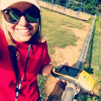
Describe the most challenging or most rewarding project you have worked on since graduating that involved the use of geospatial technology.Before graduate school, I worked as a GIS Intern at Forsyth County Schools for 6 months (January 2015 – July 2015) with another IESA alumna (Mackenzie Battista). This internship was a great transition from graduating with my Bachelor’s to moving to Flagstaff, AZ for graduate school. During this internship, Mackenzie and I digitized floor plans of the schools in GIS software by attributing features such as walls, interior and exterior doors, and windows; in addition, we created polygons of the rooms and gave the polygons attributes such as room numbers, room types, and square footage. On nice days, we did ground verification on utilities with a GPS unit. We also used a locator to find power, water, and gas lines. On hot days, we went inside the schools to verify room types and numbers to make sure the Facilities Department had up-to-date data.
What are specific skills that you acquired in the program that have helped you in your current position?
- Knowledge of GIS
- Leadership from the GeoSpatial Alliance
- Knowledge of Python/Django
Additional comments?
I think that the BS in ESA is a great program and am proud to tell people what my degree is and where I earned it!
Thanks, Corryn, for taking the time to answer our questions and best of luck on your Masters!